Description of avalanche danger
There are few places with unstable snow cover. Small creepers can be triggered on the rare patches of blowing snow, which can cause loss of balance and a fall.
Snowpack
dp.6: cold, loose snow and wind
During the last deterioration, the snowline was mostly above the highest peaks.
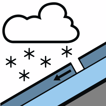
With the arrival of the cold front, it cooled down, a northerly wind blew and the snowline dropped to 1500 m. Only a few centimetres of snow fell below 2000 m, and up to 20 cm at higher altitudes.
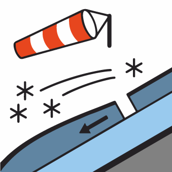
The stronger northerly wind blew the snow into the leeward slopes, with small drifts of blowing snow, especially on the southern slopes.
Snow is melting on the slopes, even in the high mountains, and will freeze overnight, increasing the likelihood of slipping.
Snow will remain dry in the arid areas.
Tendency
Snow will gradually melt on the soils, but snow will linger on the axis. Avalanche risk will remain only in a few places.